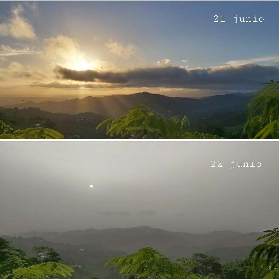
Each summer massive plumes of dust traverse the atmosphere above the tropical Atlantic Ocean, traveling 5,000 miles from the Sahara desert in northern Africa all the way to the southern United States.
While summer dust plumes are a common occurrence, the one sailing through the Caribbean over Puerto Rico right now is generating quite the buzz. That’s because it appears to be one of the most extreme in recent memory and it’s heading for the southeastern states.
The mid-afternoon closeup. In HD#SaharanDust #SAL pic.twitter.com/zKSgMJZT2o
— John Morales (@JohnMoralesNBC6) June 21, 2020
On satellite images from space, dust typically appears somewhat subtle and faint, but this plume can be seen as clear as day. The picture below was taken on Sunday from the International Space Station. “We flew over this Saharan dust plume today in the west central Atlantic. Amazing how large an area it covers!” astronaut Doug Hurley tweeted.
These plumes of Saharan dust, termed Saharan Air Layer (SAL) by meteorologists, are whipped up by strong wind storms crossing the Sahara desert. The dust enters the Atlantic Ocean near the Cape Verde islands, inside the Intertropical Convergence Zone where tropical systems often get their start.
The dust hitches a ride along the trade winds, a belt of east-to-west moving winds near the equator which become firmly established during summertime. The dust layer can extend from a few thousand feet above the surface to 20,000 feet up.
While the dust masses often stay generally intact during most of the trans-Atlantic journey, they typically become diffuse and diluted by the time they reach the Caribbean. However, so far, this particular dust layer is defying the odds.
The dust is so thick that the Meteorological Services issued a “Severe Dust Haze Warning” urging residents to take action due significantly reduced visibility and potential respiratory problems for people who experience difficulty breathing.
